The cryosphere in the HKH region is the focus of my research. I contribute to improving the current understanding of snow melt and accumulation in the HKH region. Additionally, I’m interested in imrpoving the existing regional and global permafrost maps over the Himalaya by using machine learning. I intend to study how snow affects permafrost dynamics and to derive surface deformation of permafrost areas to detect slow moving landslide in peri and postglacial environments of the HKH region.
I am passionate about remote sensing, spatial analysis and data visualization. I’ve briefly described my research area below.
- Improved understanding of snow melt and accumulation process in the HMA region
Snow covers a large area of Hindu Kush Himalaya (HKH) region. In the HKH region, the seasonal snow is a central component of the cryosphere and a primary source of freshwater for over one billion people. Obtaining accurate snow information is vital for monitoring, modeling, and evaluating snow-related hazards in the Himalayas. The dynamics of snow cover remain poorly understood. By combining remote sensing data (MODIS, Landsat, Sentinel) with field observations and empirical and physical snow models (SeNorge, FSM2, J2000), my research contributes to improving our understanding of snow processes in the HKH.
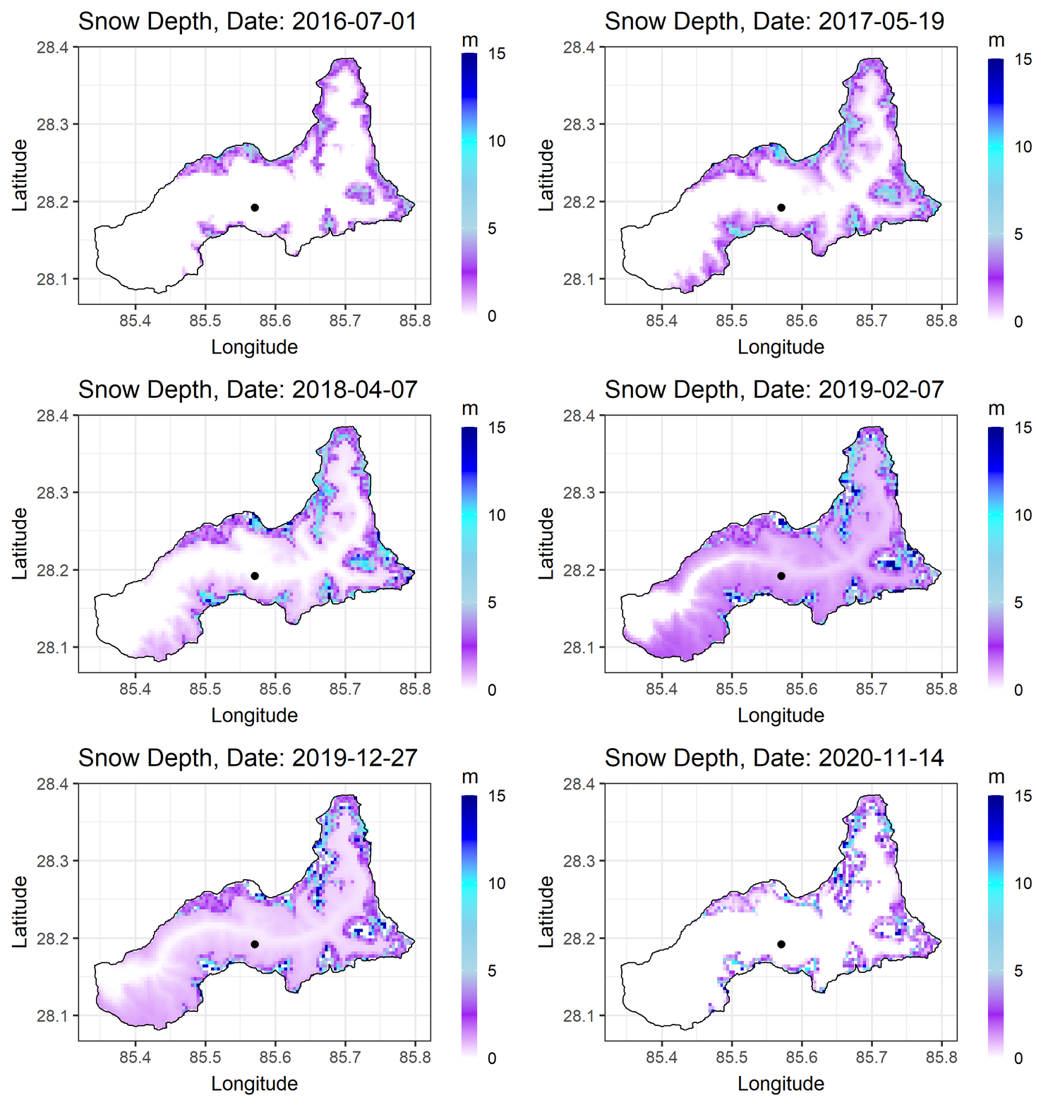
The animation below shows simulated snow depth in Langtang catchment, Central Himalaya, Nepal. Black point shows the location where there is observed snow depth station.
 ,
,
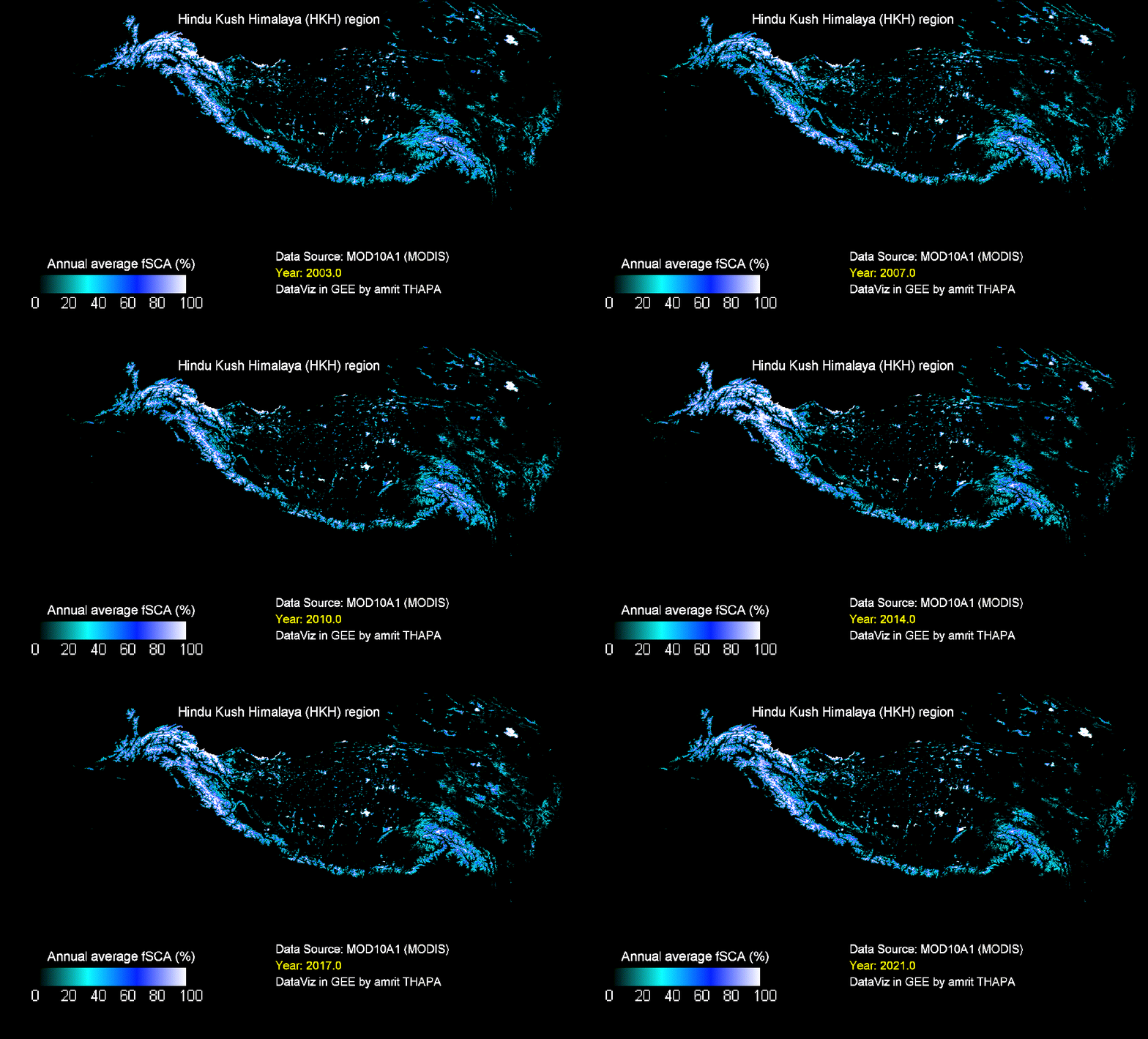
The following animation shows spatio-temporal variability of annual average snow cover over the HKH region.

- Improving existing permafrost distribution map in the HKH region
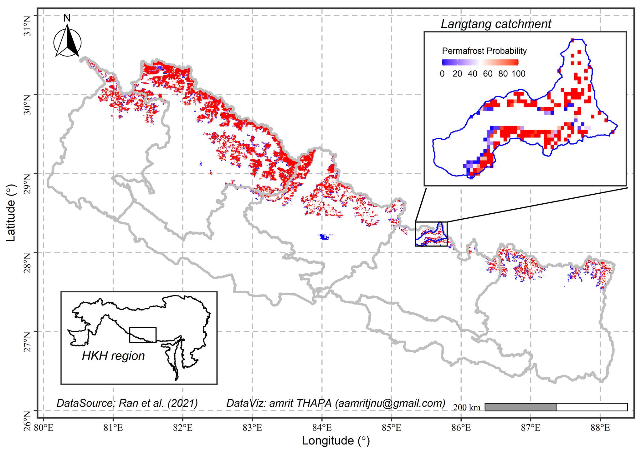
Although regional and global permafrost maps exist, they are of limited use at the local scale in the HKH region because of their lack of topographic representation (Figure below).The extent and distribution of permafrost in the mountainous parts of the Hindu Kush Himalayan (HKH) region are largely unknown, except for parts in the Tibetan Plateau. Permafrost remains poorly addressed in the Hindu Kush Himalaya (HKH) region although it contributes significantly to catchment hydrology and hazards in the region. It is partly due to the inaccessibility of the permafrost area and also due to a lack of subject experts. Permafrost change in the HKH region needs a systematic assessment to understand its impact on hydrology and hazards. More experts from the region are needed to understand the dynamics of thawing permafrost in the context of changing climate. Considering how few experts are available in this area, I am extremely interested in doing research in this area.
Through downscaling input forcing spatially, combining field observations, and using machine learning techniques, I’m preparing more accurate permafrost maps in the HKH region.

- Deriving surface deformation of permafrost area in the HKH region
We have seen an increase in mass movement occurrences over the HKH region in recent years. Many of these occurrences are cascading in nature, creating a variety of risks like landslides and floods as well as causing damage to people’s lives and property. However, we haven’t been able to collect enough data to fully comprehend the process behind such a risk.
Recent advancement in SAR technology like Sentinel 1 mission by ESA have made it possible to map flood extent at high spatial resolution. The SAR interferometry from Sentinel 1 also gives us an opportunity to estimate surface deformation at centimetre accuracy. However, the use of SAR and InSAR technology in disaster management for the Himalayan region has received relatively little attention. I’m interested in learning microwave remote sensing and use it to create time series of surface displacement which can be used in operation system to derive landslide early warning system.
